Capital of Iran
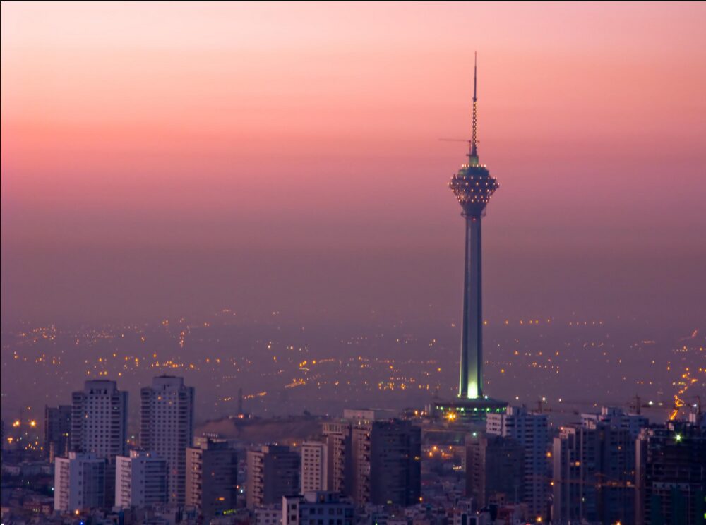
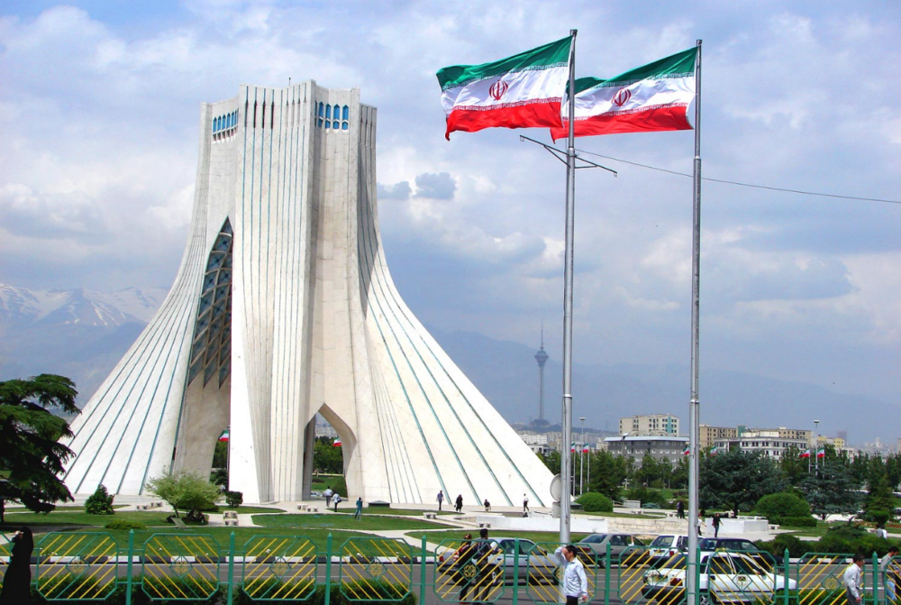
The capital city of Iran is Tehran. Most important and political and economic center of Iran being in fact its capital and the province of the same name. It is located in the north of the country, on a plateau, at the foot of the Alborz Mountains (also called Elbourz), specifically between the coordinates 35 ° 41’46 “N 51 ° 25’23” E at an altitude of 1,191 meters above sea level) and covering an area of 716.9 km². Due to its population (8,429,807 inhabitants according to estimated 2010) it is one of the most important cities in the Islamic world, together with Cairo, Istanbul, Karachi, Baghdad and Jakarta. It is important to note that more than half of the country’s industries are located there, mainly textiles, sugar, cement and automobile, among others, such as oil.
History
The capital city of Iran is Tehran have now several theories about the origin of the name of the city, one of which states that “Tehran” comes from the Persian words Tah, meaning end or bottom, and Ran, which means mountainside, which when linked resulting in literally the phrase: the end of the slope of the mountain . And since Tehran really lies in the foothills of the Alborz Mountains, this seems to be the closest to reality among all the other theories.

Between 1980 – 1988 stage of the war between Iran and Iraq the city was attacked on several occasions by missiles Scud but at the end of the same the damages caused by the Scud were quickly repaired. This war brought among other of its consequences the massive arrival of refugees to the capital, reason why the population of the city increased to a great extent.
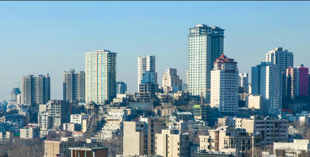
At present, the city has been modernized to a great extent although by the constructive disorder have been sacrificed historic buildings of great patrimonial value.
Interesting Facts about Tehran
Geography
Tehran is located north of the country, specifically between 35 ° 41’46 coordinates “N 51 ° 25’23” E, on a plain located on a plateau descending inclination towards the south at the foot of the Alborz Mountains . The city has an altitude of 1,191 meters above sea level, but to the south it is 1,100, in its center of 1,200 and in the north of 1,700. The city covers an area of 716.9 km².
Do you know about the capital city of Indonesia?
The city is located in an area where the transition between the barren desert (Kavir) and the mountain range of the Alborz occurs. As a result, it does not have significant aquifer resources and the two most important watersheds that collect the waters coming from the mountains upstream are located several kilometers away, they are the Karaj basin to the west and the Jajerud basin To the east .
Under the chain of the Alborz there is a great fault very close to which is located Tehran, but it is not the only one as there are many smaller faults located in the plains of the south of the city which maintains in permanent irrigation of earthquakes to the entire city.
Weather
The difference in temperature between the mountains and the plains makes the mountain air circulate to the plains at night and from the plains to the mountains during the day. The rains are very scarce and the few that occur are concentrated during the winter as the summer is very dry.
In general Tehran’s climate originates mainly from the influence of three fundamental factors, one is the introduction of hot air and dust from the desert of Dasht-e Kavir, located in the south of the city, another factor is the chain Mountainous of Alborz, located to the north of the city, that functions as a kind of barrier that stops the rains coming from the Caspian Sea and the third factor of importance are the monsoon clouds of the west that reduce in part the effects of the desert climate.

Population
In 1788 , the city had 15,000 inhabitants, but by 1950 it had grown to 1.05 million inhabitants, and a few years later in 1995, as a result of its accelerated growth, there were more than 6.8 million inhabitants Those who lived in it. This accelerated growth of the population is due mainly to the administrative and industrial development of the city and immigration from other parts of the country.
At present the city of Teherán has a population of more than 8 million inhabitants according to the last official census of 1996 .
The city has a cosmopolitan air; Tehran shelters diverse ethnic and linguistic groups from all over the country and represents the ethnic-linguistic composition of Iran. It should be noted that more than 60% of Tehran’s population was born outside the city and therefore not native to the area.
The minorities of the city include the Kurds, Mazandarani, Gilaks, Luros, Baluchos, Qashqai, Turks, Arabs, Armenians, Bakhtiari, Assyrians, Talysh, and Jews etc. There are also a number of other established minorities, who speak Punjabi & Domari and Romaní . A number of Levantine Arab speakers from Lebanon and Syria also live in Tehran.
The inhabitants of Teheran are mostly Shiites, and the minority is Sunni , Zoroastrian , Baha’i , Jewish and Christian ; including adherents of the Assyrian Church of the East , Armenian Apostolic Church , Catholic Church , Chaldean Catholic Church , Protestant Church , Iranian Church , Armenian Evangelical Church , Church Jama’at-e Rabbani , Church of the Brethren Armenia , Russian Orthodox Church , and Churches presbiterianas .
Districts
The metropolis of Tehran has increased enormously on the surface since the second half of the 20th century and now covers several departments in the province of Tehran. Most of the city is occupied by the department of Teheran but the gigantic city also extends by the departments of Eslamshahr, Ray and Shemiranat.
The department of Teheran borders the department of Shemiranat to the north, from Damavand to the east, from Eslamshahr, Pakdasht and Ray to the south, and from Karaj and Shahriar to the west.
The municipality of Tehran is divided into 22 municipal districts, each of which has its own administrative center. Which are numbered to be identified?

Tehran is divided into 112 districts including Abbas Abad, Afsariyeh, Amir Abad, Bagh Feiz, Baharestan, Darakeh, Darband, Dardasht, Dar Abbot, Darrous, Dibaji, Djannat Abad, Elahiyeh, Evin, Farmanieh, Gheytarieh, Gholhak , Gisha, Gomrok, Hasan Abad, Jamaran, Javadiyeh, Jomhuri, Jordan, Lavizan, Nazi Abad, Niavaran, Park-e Shahr, Pasdaran, Punak, Ray, Sadeghiyeh, Shahrara, Shahr-e ziba, Shahrak-e Gharb, Shemiran, Tajrish, Tehranpars, Vanak, Velenjak, Yaft Abad and Zafaraniyeh. Although administratively separated Ray, Shemiran and Karaj are often considered as part of the city of Tehran.
Economic development
45% of Iran’s largest industrial firms are based in Tehran, as well as around 30% of the country’s public sector strength, of which at least half of these workers work for the Iranian government. Most of the rest of the workers own stores, transporters and factory employees.
At present most of the modern industries of the city are dedicated to the manufacture of automobiles, electronics, electrical equipment, armaments, textiles, sugar, cement and chemical products. The city is an important center in the sale of carpets and furniture. To the south of the city and near Ray there is a crude refinery.
Transport
Tehran relies heavily on private cars, buses, motorcycles and taxis, one of the cities most in need of cars in the world, also has a metro and three airports, the International Airport Mehrabad International Airport Magnet Khomeini, and Ghal’eh Morghi Airport.
Social development
Education
In Tehran all levels of education are taught and for its size and quality the city is the largest and most important educational center in Iran, with more than fifty major universities and a large number of institutions of higher education. The University of Tehran is the oldest and largest state university in Iran. Tehran is also home to several religious colleges and seminaries as well as the country’s largest military academy.


